We left
Karen’s on May 31,2016 and drove to DeForest, WI, just north of Madison and stayed at a KOA. The drive up was a bit rainy. We’ll be back later this month, so we only
stayed 2 nights.
 |
| Donna did well in the rain, but it was exhausting. |

That gave us a chance
to tour the Trek bicycle plant, and Donna a day to catch up on work.
 |
| No photos inside, Please |
 |
| Donna wanted to sign some friends up for this |
 |
| This is where the expensive bikes are made |
 |
| A lot of specialty bikes. |
Our next
stay is six nights in Chetek, WI (north of Eau Claire). We took day trips from there, the first was
to Menominee, WI to tour the Mabel Tainter Theater.
This work of art was built posthumously for
Mabel, by her father, at the urging of the local preacher. He would also use it as his church. Check out the photos, they probably don’t do
it justice.
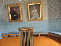
The portrait
of Mabel was painted after her death and her sister posed for it. The body is that of her sister and the head
is Mabel’s taken from a photo.
 |
| Marble stair case |

 |
| Abby peeking out |
 |
| Quilt depicting the theater |
 |
| Drinking water originally had silver cups |
 |
| Quilt depicting the times |
 |
| Quilt depicting the times |
 |
| Center tower is a radiator |
 |
| Stained Glass by a Tiffany Artist |
 |
| This preacher had quite a fancy church |
 |
| Was this preacher was an ancestor to some televangelist? |

 |
| Mabel Tainter |
 |
| This door protected the Library |
 |
| Curtain ropes |
 |
| Lighting center |
 |
| Oaklawn farm is where the Tainters lived. |
 |
| Oaklawn Stock farm |
 |
| Mens restroom with original fixtures |
 |
| Mens restroom with original fixtures |
We also thought the Chippewa Moraine Interpretive Center and State Recreation Area would be interesting.
(Moraine noun
1.
a ridge, mound, or irregular mass of unstratified glacial drift, chiefly boulders, gravel, sand, and clay.
2.
a deposit of such material left on the ground by a glacier.)
We put the address of the interpretive center into MapQuest and followed the directions. We ended up in the center of a small town and I didn't even see a name for it. I must have blinked. There was NO interpretive center here, so we tried Google Maps. Again we entered the address and proceeded to follow those directions. These instructions were different, so this must be the way. We followed along with google maps and drove into a dense forest on a dirt road,(not gravel). The road got narrower and narrower and there was water on both sides. It was pretty neat, but not where we thought we were going.

We found a place to turn around, thankfully, before we heard banjoes. We backtracked our route to the main road and were going to give up. We headed back to the campground and noticed a brown state sign off to the right. It was to the Intrepretive Center. So, after about 2 1/2 hours of driving, we found it. The volunteer told us that mapquest had entered the wrong address for the center and they were trying to get that fixed. AHH, the adventures.

Another place we visited while staying in Chetek was the Hunt Hill Audubon Camp. It has a nice trail around a large lake. There is an active beaver site there.
Donna had to work and there were mundane things that had to be accomplished, so we stayed at the RV taking care of things for a couple days.


More Abby pictures please.
ReplyDeleteThanks for doing the blog! Karen's sister now has a smaller one for long weekend trips, so I'm thinking she might be getting the fever at some point. At least we'll have plenty of people to talk with if we decide to go down that path at some point. :) Happy traveling and photo-journaling!
ReplyDeleteSo glad you are doing this!!!!!
ReplyDeletefound a place to turn around "before we heard banjoes" Love it!
ReplyDelete